Roger J. Wendell
Defending 3.8 Billion Years of Organic EvolutionSM


Honolulu from Diamond Head - February 2007
I lived on O'ahu from 1975 through 1977. Since I was only a teenager (in the Coast Guard), when I arrived on the islands, their impressions and influences on me are deep and long lasting. The downside of being a teenager, in Hawai'i, is that I had little money or photographic expertise. So, the few photos I was able to save, over the 30 years until I created this page, are the best I could come up with at the time. The oldest photos are on the bottom half of this page with all the newest stuff, from later visits, on the top half:
Devastation:
(Lahaina was an historic whaling village and the former capital of the Hawai'ian Kingdom)

Facts and Figures:
The Hawaiian Archipelago is comprised of 18 islands and atolls extending across a distance of 1,500 miles (2,400 km). Eight of these are considered the "main islands" and are located at the southeastern end of the chain. The Hawaiian islands total 6,427 square miles in area making Hawai'i the 47th largest state - slightly larger than Connecticut (4,872 Sq miles) and bit smaller than New Jersey (7,468 Sq miles).Hawai'i became the 50th state on August 21, 1959. The islands are located about 2,300 miles (3,700 km) from California and are also known as as the Sandwich Islands. The State's population, at the time of our last visit in 2007, was approximately 1,300,000 - that included permanent residents, military and tourists. The southern tip of Hawai'i Island is also the most southern point in the United States (Alaska remains the western most state...).
Hawai'i was first inhabited by Polynesian settlers sometime around 1000 CE (Common Era). It's believed these peoples came from islands in the South Pacific, most likely the Marquesas. For about 800 years the Hawaiian people lived in a complex caste system governed by warring chiefs and an extensive set of religious and social rules called the "Kapu" system.
British explorer James Cook was probably the first European to stumble upon the islands, in 1778, although there's some indication the Spanish may have wondered into the area a bit earlier. Cook, who named Hawai'i the "Sandwhich Islands," was killed on the Big Island in 1779. Cook and his crew were engaged in a dispute with locals during one of their religious observations, over the theft of his ship's small-boat at Kealakekua Bay, and was whacked on the back of the head when he tried to return to his ship...
In the very early 1800s the warrior known as Kamehameha was the first, ever, to have conquered and controlled all of the major islands at one time. He accomplished this mostly by force although a couple of the islands cooperated without fighting. About nine decades later, Queen Liliuokalani gave the U.S. government control of the islands in her effort to avoid bloodshed between non-native residents and her Hawaiian people. I have a note about the United States' official apology for this incident at the page bottom.
However, more important than human conflict is the devastation Hawai'i (and the rest of the planet) has endured at the hands of ancient and modern peoples. During the first 20 years of the Endangered Species Act (signed into law by President Nixon in 1973) 114 species went extinct - nearly half of those were in Hawai'i! Further back, the arrival of Polynesians in Hawai'i, ten centuries ago, caused the extinction of at least 39 species of endemic (indigenous) land birds. And, although I haven't found an Internet reference to it our guides told us it was common for warring Hawaiian chiefs to burn down Lāna'i and parts of the other islands during countless conflicts. Finally, of course, the huge numbers of people living, building, and consuming on the islands has had a devastating effect - just like everywhere else in the world.
- Roger J. Wendell
February 2007

O'ahu
(the "Gathering Place") 596 Square miles. 2007 Population aprx 900,000
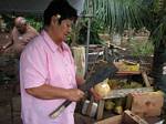 Cutting the coconut |
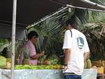 Buying the coconut |
 Drinking the coconut |
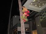 Waikiki climber... |
 Bonzai Pipeline |
Diamond Head (Lē'ahi)
State Monument:

|
Click Here for a park pass... |
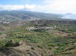 Diamond Head crater |
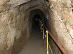 Diamond Head tunnel |
 Diamond Head trail |
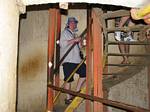 Diamond Head stairs |
 Honolulu from Diamond Head |

|
Click Here for a copy of the Diamond Head hiking certificate! |
Wahiawa and
the rest of O'ahu:
When we got married, in February '77, our first apartment together was in a place called "Waikalani Woodlands" in what is now labeled Launani Valley. It was a wonderful setting in a small valley beneath what is now the H2 freeway. Even today, during our 2007 visit, Waikalani Woodlands remains green, quiet, and serene. Of course that kind of environment comes at a steep price on such a crowded island. Back in '77 I believe our rent was $300 or $325 per month - although expensive for us it remained very much worth the price.Our street address, back then, was 95-269 Waikalani Drive, Wahiawa, HI 96786 (it's since been changed to Mililani 96789...). The hyphen ("-") in our address is a common delineator for rural addresses throughout O'ahu and on parts of the Big Island and Kaua'i (Kaua'i uses only one digit before the hyphen and the Big Island doesn't use the hyphen on it signage). O'ahu, except for military basis and heavily populated areas, is divided into nine districts/tax zones, each subdivided into nine sections. The first two digits of an address, before the hyphen, indicate the tax zone while the three (sometimes four) digits after the hyphen are the address numbers. Lāna'i, Māui, and Moloka'i, and parts of the other islands (mainly urban areas and military bases) maintain conventional numbering systems

|
Click Here for the time I spent on O'ahu, with the Coast Guard, during the mid '70s... |

Māui
(the "Valley Isle") 727 Square Miles. 2007 Population aprx 140,000
The Aina-Nalu apartments, in Lahaina, gave us the most wonderful upgrade for our 30th anniversary! The accommodations were perfect so it was difficult to leave each day, to explore Māui, but we did! Part of our travels took us the entire length of the Hana Highway, probably one of the most difficult and beautiful (at the same time!) roads in the world. Since we have a personal vacation policy of letting the traffic beat us (we leave hotels and apartments at about 10:00 am, on average, any given morning) we had most of the Hana Highway to ourselves - in complet contrast to the slow moving traffic jams that have made it legendary... Anyway, about eight or ten miles past the hamlet of Hāna, itself, we parked at the mouth of Kipahulu Valley where we hiked a few miles up to the 400 foot Waimoku Falls. Again, we had the entire valley, and waterfalls, to ourselves as it was later in the day. And, since Kipahulu Valley is the southern part of Haleakala National Park we were able to use the same entrance pass that had allowed us earlier access to 10,023 foot summit of Haleakalā.Back at Lahaina, we boarded the Pacific Whale Foundation's observation boat where we were able to watch dozens of Humpback whales breaching, jumping, and diving in the Auau Channel between Māui and Lāna'i. Observation boats can come within 100 yards of a whale, by law, so I was able to photograph a few whale tales with our simple (12x) digital camera. According to the onboard biologist, the whales come down to Hawai'i, from Alaska, for breeding. Interesting to note that the waters off Hawai'i are clear because they're basically nutrient deficient - the whales have nothing to eat, while visiting Hawai'i, so females not interested in mating stay in the cold waters off Alaska...
As I mentioned, we drove to the 10,023 foot summit of Haleakalā Crater where it's cold and extremely windy. As you can see from the photo, a very popular activity is to ride bicycles from Pu'u Ula'ula (Red Hill, at the summit) down the entire length of Haleakalā Crater Road. Dozens of cyclists are engaged in this activity at anytime during the day...

Lāna'i
(the "Pineapple Island") 140 Square Miles. 2007 Population aprx 3,200
We made our way over to Lāna'i by boat from Lahiana - a trip of about an hour across the Auau Channel where we again saw more whales but not so close (and slow) this time around. Our private guide for the day was 55 year old Bruce Harvey who was born on O'ahu and had lived on Lāna'i for the past seven years. Bruce was a huge wealth of information on every aspect of Lāna'i and Hawaiian culture in general. Although Lāna'i "felt" pretty big to us Bruce's 4WD tour covered the entire island in five hours!!98% of Lāna'i is privately owned by billionaire David H. Murdock who gained possession of the island in 1985 when he purchased Castle & Cooke - owners of the Dole Food Company who bought the entire island in 1922. The remaining 2% of the island is owned by the few hundred families who have built homes in Lāna'i City where, historically, properties were purchased from the Hawaiian Pineapple Company (Now known to many of us as Dole Pineapple or the Dole Food Company) by the plantation workers.
Although I'm far from knowledgeable about the island of Lāna'i, and its politics, it seems apparent that Mr. Murdock is doing a pretty good job of keeping the island in its natural state. However, the island has seen some historical abuse as its entire forest was burnt down, by warring Hawaiians, and all of its population either killed or removed by these chiefs as well (hence the island was eventually able to fall into private hands since nobody was living on it...).
From what I understand, David Murdock maintains tight control over development and plans to pass the entire island on to a conservancy after his own death. Too bad there aren't similar plans to arrest development around the rest of our country but that's another story and web page in itself...
P.S. As you can see from the photo, above, the original jail on Lāna'i was in an icehouse. It's not longer in use as there's a more modern police facility available a couple blocks away. For that matter, everything in Lāna'i City is only a couple blocks away!

Hawai'i Island
(the "Big Island") 4,038 Square miles. 2007 Population aprx 160,000
Near Polulu Valley on the Big Island
South Point Complex
South Point Complex
Mauna Kea telescopes 13,796 ft
Submillimeter Array
Road up Mauna Kea
Note: South Point Complex is the southern most point in the United States!

|
Click Here for my page on astronomy and more photos on top of Mauna Kea... |
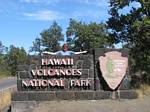 Entrance to Volcanoes NP |
 My rented convertible |
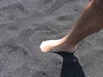 Punalu'u Black Sand |
 Jungle hiking |
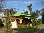 Pololu Valley Store |
Lots of Lava on the Big Island:
 Warning to Hikers |
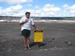 Volcano fumes |
 Volcano steam vent |
 Volcano steam vent |
 Steam vent |
 Lava on the road... |
 Roger hiking |
 Lava field |
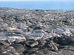 Lava field |
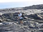 Roger playing in the field... |

|
Click Here for my video of the flowing laval and tourists... |
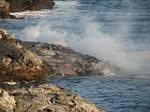 Lava into the sea |
 Lava in the sea |
 Lava gamers |
 Lava field |
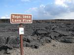 1982 Lava Flow |
 Lava toe |
 Lava toe |
 Lava toe |
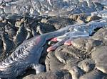 Lava toe |
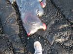 Roger's toe... |
 Lava tube |
 Lava tube |
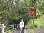 Lava tube entry |
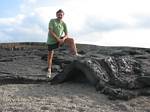 Lava fold |
 Roger photographs the Lava... |
I enjoyed Mauna Kea so much we took a second trip up, a day later, after sunset! During the first day we had the distinct pleasure of touring one of the Keck twins (the W.M. Keck Observatory houses the world's two largest telescopes) and actually watch them rotate and pivot the 10 metre telescope. The night we returned we parked our convertible near the big scopes, took down the roof, and laid back to watch the stars, planets, and meteors unfold before us. At the 13,796 foot summit the temperature was still in the 40 degree range - relatively comfortable by Colorado standards, with the air almost perfectly still. It was also a bit eerie to hear the various telescope domes slowly turning around us in the dark all evening - quite the experience! It's a bit embarrassing to admit that I drove 1,003 miles in the rental car during our five day visit to Hawai'i Island. But, this enabled us to see "tons" of interesting beaches, archeological sites and telescopes - all in addition to spending an evening with nephew Dustin studying Geology at the University of Hawai'i at Hilo.South Point Complex, the southern most point of the United States (Alaska remains the furthest west of any state), was well worth the extra 25 miles of driving off State Highway 11. A bit further down the road, of course, is Volcanoes National Park where we hiked right up to the edge of a live lava flow, inhaled the warm-moist sulfur fumes of the volcano's vents, and hiked the length of a huge, underground lava tube. Actually, the "live-lava" experience was a bit dangerous as the fumes can be damaging and the heat deadly. And, if you're not careful, you can step through crust of a lava "toe" and completely engulf your foot, ankle and leg in 2,100 degree molten lava. The Park Service does a pretty good job of protecting tourists except for those (like us) who hike too far into the backcountry - out of range of trail markers, guide ropes, and danger signage...
The Big Island also afforded me a chance to experience black sand beaches, watch turtles come ashore, and play in waves almost as big as O'ahu's north shore.

|
Click Here for the various waypoints we recorded on each island... |

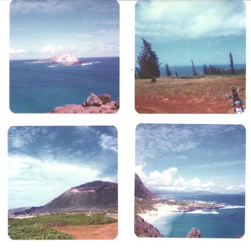
Although I did acquire a bit of "Island Fever" (the desire to be surrounded by vast prairies or mountain ranges can cloud your view even in paradise!), at times, I feel lucky to have experienced so much at such a young age! At left are four pictures from O'ahu during February, 1976. At the time I owned a 1972 Honda CB 450 - very similar to the CL 450 that I owned in Colorado (The "CB" was the street version while CL, on Honda motorcycles, usually indicated off road or trails...) - I used the 450 to take me just about everywhere on O'ahu. Anyway, you can see the bike parked in one of the photos...
While in Hawai'i I did a "ton" of snorkel and scuba diving. I did acquire an underwater camera, while scuba diving, but lost a lot of photos after it floated away from me one day in Hanauma Bay...

|
Click Here for my Coast Guard page... |
Sugar Cane
"I don’t wanna pickle. I just wanna ride on my motorsickle." (Arlo Guthrie)

Japan loves Hawaiian bottled water!
Bottled Water Translation:
When I lived in Hawai'i, during the mid 70s, there was a pretty strong Japanese influence that grew even more prominent after I left (so I'm told). Anyway, in 2004 my family and I took a trip to Japan and were delighted to find this bottled water named "Hawaii!"
"Hawaii, Kailuah, Kona - Deep Ocean Water 250""Hawaiian Deep Ocean Water" is said to slowly travel the earth at depths of around 5000m as the eons pile one on top of another. This deep water has quietly continued to circulate the earth and is loaded with magnezium which essential to human health. It is "a gift from the ocean depths." The water has traveled from the northern atlantic ocean, to the pacific ocean where it is drawn up from the deep see off of Hawaii and named "Kailuah, Kona Deep Ocean Water." Hawaii, with its clean air and water, is still an island where this mysterious deep ocean water is born and even the worlds natural scientists have taken notice.
picture:
title: Mauna Keia
island shape :kona
pipe looking thing: suction pipe
current looking thing : deep waterbelow picture:
Usage information : After opening refrigerate and please drink before the expiration date

More Miscellaneous Hawai'i pix
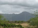 Navy antennas at Lualualei |
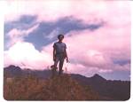 Me at Lualualei, O'ahu |
 1966 VW "Volksie Walden" |
 North Shore, O'ahu - 1976 |

Hawaiian Sovereignty Movement
Yankee go home!While living in Hawai'i, during the mid 70s, it was clear to me that original peoples weren't happy with the 100+ year European/American occupation of the islands. While I was there, at the tail-end of the Vietnam War, the Hawaiians (and most of the rest of country!) didn't have much appreciation for the U.S. military. It was at about that time, while I was there, that a groupd called Protect Kaho'olawe 'Ohana (PKO) began to occupy Kaho'olawe to halt the military's practice bombings. The PKO also filed environmental lawsuits, in federal court, with the island eventually being returned to the state and turned into a reserve that can only be used by native Hawaiians not engaged in commercial operations (The smallest inhabited Island, Ni'ihau has equally serious restrictions as well...).
Besides the Kaho'olawe issue, I also saw various signs that most native Hawaiians (who are very small minority in the overall population) wanted the rest of us out. However, that's not unlike many reservations and foreign countries I've visited around the world. Who can blame the Hawaiians, Tibetans, Palestinians, or anyone else for wanting the foreigners out? Of course, the sad reality is that "might makes right" so we won't be seeing any major changes for oppressed peoples anytime soon. And, Hawai'i is especially cursed because the Chinese and Russians have been coveting the archipelago for dozens of decades - both much more brutal and unforgiving than the United States by any measure.Anyway, from what I understand of the Hawaiian sovereignty movement is that its comprised of a loose coalition of groups that seek self-determination and self-governance for Native Hawaiians and redress from the U.S. government for its alleged role in the 1893 intervention and overthrow of Queen Lili'uokalani and the prolonged military occupation that began 1898. The Hawaiian Sovereignty movement overlaps with the Aloha 'Aina movement (love of land movement), and other groups, so there's some confusion over demands, desires, and tactics. Anyway, the two photos (above, right) are some evidence that these movements are still alive in Hawai'i...
O'ahu "Reinstated Government" - February 2007Note: In 1993, 100 years after Queen Liliuokalani yielded her authority to the United States Government rather than to the Provisional Government of Hawai'i, United States Public Law 103-150 went into affect. The 1993 law was an apology "to Native Hawaiians on behalf of the people of the United States for the overthrow of the Kingdom of Hawai'i on January 17, 1893." Apparnatly the Queen gave her authority to the U.S. to avoid bloodshed between her people and a group of non-Hawaiian residents working to overthrow the indigenous and lawful Government of Hawai'i. Besides just U.S. interests, China, Japan, Russia and a few other places also had their eye on Hawai'i over the years as well ...
Protesters held after takeover of Hawaiian palace
August 16, 2008
HONOLULU (AP) -- Officers have arrested about 20 pro-sovereignty activists after the second takeover this year of the grounds of a Honolulu palace.State law officers climbed a fence and made the arrests Friday evening at the historic Iolani (ee-oh-LAHN'-ee) Palace.
About a dozen men had locked the palace gates and posted signs saying: "Property of the Kingdom of Hawaiian Trust."
Hawaiian activists have long used the palace as a location for protests against U.S. occupation of the islands. A different group occupied the palace grounds in April.

Anthropology
"FOR NEARLY ALL OF THE FIVE MILLION YEARS SINCE IT VIOLENTLY EMERGED from the depths of the Pacific Ocean, Hawaii was defined by its isolation. Its first settlers, probably Polynesians from islands to the south, are thought to have arrived roughly around the time of Christ. Over the centuries, Hawaiians had little contact with anyone else because almost no one could cross the vast expanse of ocean that surrounded their islands. Thousands of unique plant and animal species evolved, more than almost anywhere else on earth.""Hawaii's human inhabitants developed a remarkably distinctive society that bound them together in elaborate webs of obligation, ritual, and reverence for nature. If not precisely a tropical Eden, this was a place where, over many generations, people maintained a well-balanced culture that sustained them both physically and spiritually. One historian has described it as 'very successful' and 'less brutish than were most of its contemporary societies throughout the world, even those of patronizing Europe, just as it was less brutal than are most of those that adorn our civilized world today.'"

Extinction:
Dave Foreman, in his book, Rewilding North America
(A Vision for Conservation in the 21s Century) pp. 27-28
"The Hawaiian Islands are a poster child for extinctions caused by European contact - between eighteen and thirty species of endemic birds have become extinct in the last two hundred years. But recent research by avian paleontologists Helen James and Storrs Olson of the Smithsonian Institution shows that most bird extinctions in Hawaii did not come after Captain Cook became the first European to visit, in 1778, but after the first Polynesians arrived, in AD 400, well before Cook's arrival. Their research has 'unearthed at least 50 previously unknown species of birds which went extinct' before Cook reached the islands, including a close relative of the bald eagle, an accipiter hawk, three species of long-legged owls, four flightless geese, three flightless ibises, and fifteen Hawaiian honeycreepers (a group unique to Hawaii). According to ornithologist Lyanda Haupt, the rigidly European Polynesian culture that settled Hawaii burned off vast tracts of lowland forest for farming, hunted the large flightless birds for meat, slaughtered the brightly colored songbirds for ceremonial robes (eight thousand birds were required for one robe), and released pigs and the Polynesian rat, an alien predator. E. O. Wilson writes bluntly, 'The Polynesian seafarers . . . broke the crucible of evolution.'"

Books:
"For us there is only one name," the old man insisted in a burst of rhetoric. "Havaiki of the manifold riches, Havaiki of the brave canoes, Havaiki of strong gods, and courageous men and beautiful women, Havaiki of the dreams that led across the endless oceans, Havaiki that has lived in our hearts for forty and fifty and sixty generations. This is the island of Havaiki!"
Links:
|
|

 Back to Roger J. Wendell's Home Page...
Abbey |
About |
Blog |
Contacting
Me |
Copyright |
Disclaimer |
Donate |
Guest
Book |
Home |
Links |
Site
Index |
Solutions |
Terms,
Conditions
and
Fair
Use |
What's
Changed
or
New?
Copyright
© 1955 -